
Maceio
Sao Paulo (disponible soon)
164 millions.
Portuguese navigator Pedro Alvares Cabral discovered Brazil in 1500.
From then on, various export cycles dominated Brazil's economic development. The first of these cycles was based on the exportation of brazil wood, used to make dyes and paints. During the 17th century, Brazil became the world's largest producer of sugar. In this period, a large number of African slaves were brought to Brazil to work in the sugar cane plantations. Gold and diamonds eventually replaced sugar as the country's major export product. By the second half of the 19th century, Brazil was deep in a new cycle with coffee as the major export. Today, coffee is still one of Brazil's major sources of income. The late 19th-century rubber boom also brought prosperity and development to the north of Brazil, previously ignored by the international economy. When Napoleon invaded Portugal in the early 1800's, Dom João VI King of Portugal, fled to Brazil where the Portuguese court continued to run the empire. Ports were opened to international (mostly British) commerce, and the colony grew substantially. In 1789, one of Brazil's first movements for independence from Portugal was crushed. Its hero, Tiradentes, became a national symbol of liberty. Independence was finally proclaimed by Dom Pedro I (Dom João's son) in 1822. He became Brazil's first Emperor. His son, Dom Pedro II. reigned for 49 years until 1889 when the country became a Republic. In 1888, slavery was abolished. In 1940 Brazil began a new phase characterized by industrial development.
Most of Brazil can be visited comfortably throughout the year, it s only the south, which can be unbearably sticky in summer and non stop rainy in winter, that has extreme seasonal changes. With many Brazilians on summer vacation from December to February, travel can be difficult and expensive, while from Rio to the south the humidity can be oppressive. Summer is also the most festive time of year, as Brazilians escape their apartments and take to the beaches and streets. School holidays begin in mid December and go through to Carnaval, usually in late February.
Portuguese
Electricity: Unstandardized; 110 or 120V, 60 Hz in Rio and São Paulo
Weights & measures: Metric.
Cruzeiro real (100 centavos).
- For Canadians, please visit this web site. Travel information and advisory reports
- For others nationalities, please check with the Consulate or the embassy of the country you want to visit.
Avocado Ice cream
- 3 medium ripe avocados (peeled and pitted)
- 2 tablespoons milk
- 1/2 teaspoon vanilla extract
- 1/4 cup sugar
- 2 egg whites
Place the avocados, milk and vanilla extract in a blender. Liquefy. Beat the egg whites into stiff peaks, adding the sugar a little at a time. Fold the egg mixture into the avocado mixture in ice cube trays. When the mixture begins to freeze, remove and beat until smooth. Return it to the freezer. Serves four.
|
 |


Brazil is the largest of the Latin American countries. Covering nearly half (47.3%) of the continent of South America, it occupies an area of 3,286,470 sq. miles (8,511,965 sq. km.). It is the fifth largest country in the world after the Russian Federation, Canada, China, and the United States. In continental South America, Ecuador and Chile are the only two countries that do not share a border with Brazil. The Equator passes through the north of the country near Macapa, while the Tropic of Capricorn passes through the south of the country near São Paulo. The Atlantic Ocean stretches across the eastern side of the country, giving it a coastline of 4,578 miles (7,367 km). It is estimated that 165 million people live in Brazil. Although 90 percent of the country lives in the tropical zone, most of the population lives in areas where altitude, sea winds, or cold fronts moderate the temperatures. Plateau cities such as São Paulo, Brasilia and Belo Horizonte have very mild climates averaging 66 F (19 C). Coastal cities such as Rio de Janeiro, Recife and Salvador have warm climates balanced by the constancy of the trade winds. Farther south, in cities such as Curitiba and Porto Alegre, the cooler subtropical climate resembles many areas of the U.S. and Europe, with winter temperatures often falling below freezing. Despite its reputation for blistering heat, the Amazon region rarely experiences temperatures above 90 F (32 C). The hottest part of Brazil is in the northeast where, in the dry season between May and November, temperatures above 100 F (38 C) are recorded frequently. The heaviest rainfall in Brazil is found around the mouth of the Amazon River, near the city of Belém, and also in upper Amazonia, where more than 78 inches of rain falls every year. Unlike the Amazon region, however, most of Brazil experiences moderate rainfall, usually between 39 and 59 inches a year. Most of this rain falls in the summer, between December and April, while the winter months tend to be dry. This is especially true in the northeast, where rainfall is inconsistent and the evaporation rate is very high. Along the coastal areas, particularly south of Recife, the mountains trigger rainfall from the Trade Winds. In some places, such as the region south of Salvador, the lands are drier because the rain falls in the mountains. The seasons in Brazil are the reverse of those in the U.S. and Europe.
Capital
Brasilia
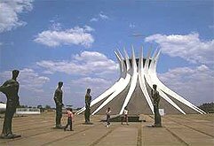
Since the second half of the 18th century, Brazil's governing authorities considered, with varying degrees of intensity, transferring the seat of government from Rio de Janeiro to some inland area, safe from naval attacks. The first Republican constitution (1891) went as far as defining where the future Federal District would be - a rectangle within the State of Goias, in the heart of the country. But it was not until 1956, after eight years of surveying, that the actual design and construction of the new Capital began under President Juscelino Kubitschek. The site chosen for Brasilia is located in the Federal District and comprises 2,245 sq. miles (5,814 sq. km) of a sparsely inhabited plateau carved out of the State of Goias, 3,609 feet
(1,100 meters) above sea level and 746 miles (1,200 km) from Rio de Janeiro.
The competition for the urban master plan was won by Brazilian architect and urban planner, Lucio Costa. The major government buildings were designed by the Brazilian architect Oscar Niemeyer. Landscape designer Roberto Burle Marx planned the layout and selection of plant varieties to add a vivid green backdrop to the otherwise dry, yellow landscape of the savanna vegetation. On April 21, 1960, Brasilia was officially inaugurated and started functioning as the new capital of Brazil. Its population is about 1,750,000 inhabitants.
What to see and what to do
Rio de Janeiro
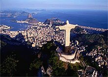
Corcovado, the mountain peak with the statue of Christ the Redeemer at its summit, offers the best way to become geographically familiar with the city.
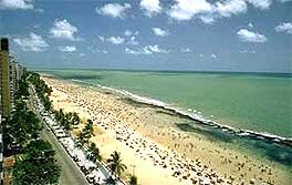
Copacabana is probably the world s most famous beach, and runs for 4.5km 3mi in front of one of the most densely populated residential areas on the planet. From the scalloped beach you can see the granite slabs that surround the entrance to the bay. Ipanema is Rio s richest and most chic beach.
Pão de Açúcar, or Sugar Loaf, is God s gift to the picture postcard industry. Two cable cars climb 1300m 4264ft above Rio and the Baía de Guanabara and, from the top, Rio looks the most beautiful city in the world.
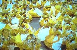
 Rio s famous glitzy Carnival is a fantastic spectacle, but there are more authentic celebrations held elsewhere in Brazil. In many ways, Carnival can be the worst time to be in Rio. Everyone gets a bit unglued at this time of year, taxi fares quadruple, accommodation triples and masses of visitors descend on the city to get drunk, get high and exchange exotic diseases, so be careful. Rio s famous glitzy Carnival is a fantastic spectacle, but there are more authentic celebrations held elsewhere in Brazil. In many ways, Carnival can be the worst time to be in Rio. Everyone gets a bit unglued at this time of year, taxi fares quadruple, accommodation triples and masses of visitors descend on the city to get drunk, get high and exchange exotic diseases, so be careful.
|


